A Video Retrospective of the Colorado Trail

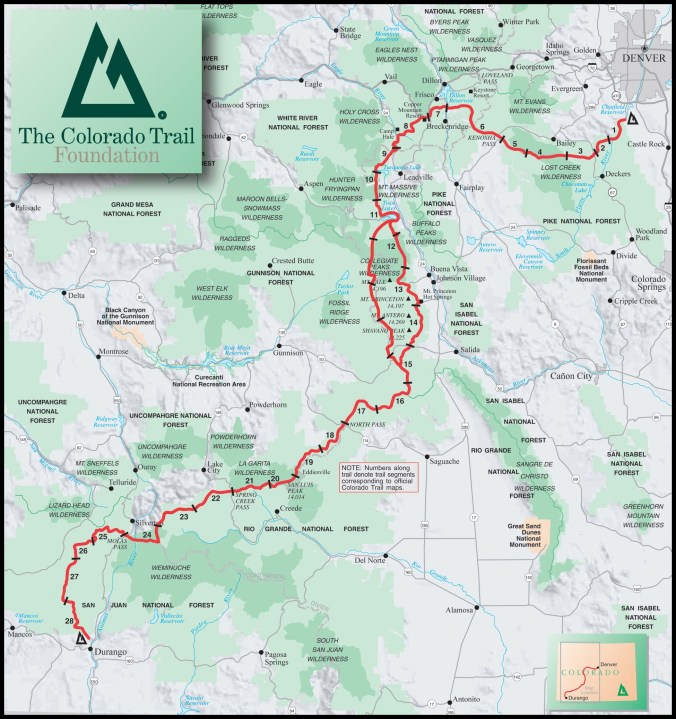
colorado_trail_map-1

VA and I had been working as caretakers of a property in Big Sur over the last year, and besides a quick trip to Death Valley, hadn’t been on a long walk since our back to back high routes last year.  Living simply in the Sur afforded us the time and space to get out and wander the coastal ranges of central California, skimming the beaches for jade, running the ridges and valleys, hosting friends and family, and exploring more deeply a place we both hold dear.  It also allowed us the mental space to plan another series of summer adventures, including a return to the SHR, the Colorado Trail, and the Low2High Route.   And then there was the Soberanes Fire.  It’s birth came as an illegal campfire, was first reported as a 5-acre brush fire, and over the last two months has grown and matured into a full-fledged backcountry wildfire (currently over 125,000 acres and the most expensive fire in American history).

The ridge we were living on was evacuated two days before our departure date, and we left the Sur as flames crested Mt Manual and started making their way into the valley.  We headed east to the Sierra for a quick section of Roper’s route, and then made our way back to Durango, the town in which VA and I met in 2012.  We parked Occupanther at a friend’s house, rented a car, and drove to Denver to begin the CT.  It took us twenty-two days to walk the five-hundred miles from Denver to Durango.  Many of those miles and feelings were captured in the video below.  Turn up the volume and enjoy.
We’re not dead!

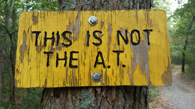
Not AT


A year after leaving Big Sur on bicycle, we’re back out west in Oregon to live, love, and jump back into the working game.  If you’ve been trying to keep up with us through our updates on here, you must have assumed we fell off the face of the earth somewhere along the Appalachian Trail in southern New Jersey. Continue reading

“Oh my god, it was near-impossible!”

Common among hikers is a way of talking, of storytelling that is seemingly meant to scare fellow hikers; an explosion of a simple experience into something near-impossible or almost-unattainable. The exchange usually ensues as such:
Hiker A – “Hey, how was the ascent of Mount X?”
Hiker B – “Oh man, it was so gnarly! There were slabs of granite at almost a 90 degree angle that were all moss-covered and you couldn’t climb up without using both hands and feet! One small misstep and you’d definitely plummet right off the mountain!”
Continue reading

No Pain, No Maine: A Month in Photos

The old AT thru hiker adage, “No Pain, No Maine”, normally applies to northbound (NOBO) hikers and is used to keep spirits up as they push through the first 2,000 miles, essentially implying that without a bit of pain and suffering, you will never finish the trail.

Well since we’re southbound (SOBO), we started with the hardest terrain first, and we soon realized that the saying applies to us SOBO’s too, because, well, Maine hurts. From ankles to knees, backs and buttocks, the first 300 miles of the trail worked us like a couple of couch potatoes. Continue reading

The 100 Mile Wilderness in 5 Days

IMG_5478


Banana pudding, peach cobbler, vanilla ice cream, hand-tossed pizza, Cinnamon Toast Crunch, fresh fruit and crisp vegetables, moist homemade carrot cake, savory hummus and salty Pringles, pasta, butterscotch fudge, swiss cake rolls with espresso, pop tarts.  Fucking pop tarts.  This was the gist of our conversation as we ascended White Cap Mountain, our first major climb since heading south out of Baxter State Park. Continue reading